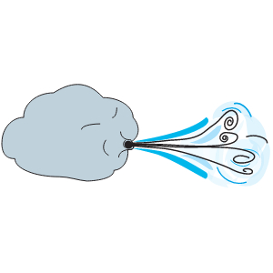
Weather: wind 3
Ecosystems - Meteorology, Climate

Related Symbols


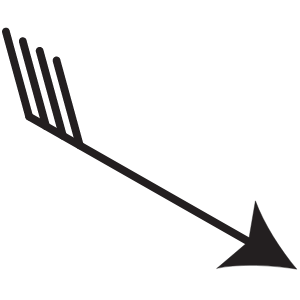
. The term can also apply to the resultant wind vector which is sometimes drawn as an arrow with length proportional to wind speed")
Weather: wind vector
Illustration of a wind vector, the two- or three-dimensional vector describing the instantaneous wind magnitude and direction at a point (often using Cartesian coordinates; i.e. X and Y wind vectors). The term can also apply to the resultant wind vector which is sometimes drawn as an arrow with length proportional to wind speed
Weather: wind vector

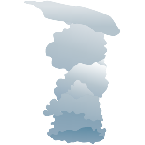
Low clouds: Cumulonimbus 1
Illustration of cumulonimbus clouds, tall, dense, and involved in thunderstorms and other intense weather. Cumulonimbus means "column rain" in Latin. It is a result of atmospheric instability. These clouds can form alone, in clusters, or along a cold front in a squall line. They create lightning through the heart of the cloud. Cumulonimbus storm cells can produce heavy rain (particularly of a convective nature) and flash flooding, as well as straight-line winds
Low clouds: Cumulonimbus 1

Middle clouds: Altocumulus 1
Illustration of a cloud belonging to a class characterized by globular masses or rolls in layers or patches. Alto, "high", cumulus, "heaped". Usually white or gray, and often occurs in sheets or patches with wavy, rounded masses or rolls. Often are seen preceding a cold front, and their presence on a warm, humid, summer morning frequently signals the development of thunderstorms later in the day
Middle clouds: Altocumulus 1

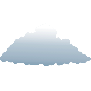
Low clouds: Stratocumulus 1
Illustration of stratocumulus clouds, belonging to a class characterized by large dark, rounded masses, usually in groups, lines, or waves. Weak convective currents create shallow cloud layers because of drier, stable air above preventing continued vertical development. Vast areas of subtropical and polar oceans are covered with massive sheets of stratocumuli
Low clouds: Stratocumulus 1

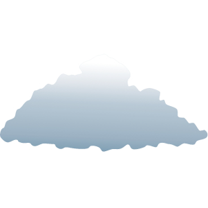
Low clouds: Cumulus 1
Illustration of a cumulus cloud, a cloud with noticeable vertical development and clearly defined edges. Cumulus means "heap" or "pile" in Latin. They are often described as "puffy" or "cotton-like" in appearance. Cumulus clouds typically form when warm air rises and reaches a level of comparatively cool air, where the moisture in the air condenses. This usually happens through convection, where a parcel of air is warmer than the surrounding air