Ecosystems - Meteorology, Climate


 Each cloudlet appears no larger than a finger held at arms length. It occurs in patches or sheets, organized in rows like other cumulus, but since they are so small, cirrocumulus patches take on a finer appearance, sometimes referred to colloquially as")
High clouds: Cirrocumulus
Illustration of a cirrocumulus cloud, a large, white patch or tuft without a gray shadow. Composed of supercooled liquid droplets (if they freeze, becomes cirrostratus - cirrocumuli are short lived) Each cloudlet appears no larger than a finger held at arms length. It occurs in patches or sheets, organized in rows like other cumulus, but since they are so small, cirrocumulus patches take on a finer appearance, sometimes referred to colloquially as "herringbone" or "mackerel"
High clouds: Cirrocumulus

High clouds: Cirrostratus
Illustration of cirrostratus clouds, thin, generally uniform clouds, composed of ice-crystals, capable of forming halos. When thick enough to be seen, they are whitish, usually with no distinguishing features
High clouds: Cirrostratus
 name of mare's tail. Cirrus clouds are formed when water vapor freezes into ice crystals at altitudes above 8000 meters (26,000 ft). Due to the sparse moisture at a high altitude, they tend to be very thin")
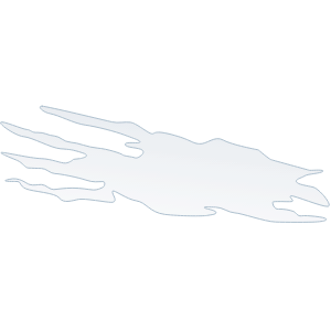
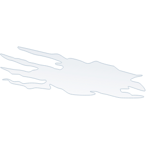
High clouds: Cirrus
Illustration of cirrus clouds, which are characterized by thin, wisplike strands, often accompanied by tufts, leading to their common (non-standard) name of mare's tail. Cirrus clouds are formed when water vapor freezes into ice crystals at altitudes above 8000 meters (26,000 ft). Due to the sparse moisture at a high altitude, they tend to be very thin
High clouds: Cirrus

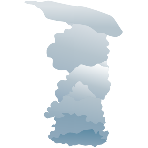
Low clouds: Cumulonimbus 1
Illustration of cumulonimbus clouds, tall, dense, and involved in thunderstorms and other intense weather. Cumulonimbus means "column rain" in Latin. It is a result of atmospheric instability. These clouds can form alone, in clusters, or along a cold front in a squall line. They create lightning through the heart of the cloud. Cumulonimbus storm cells can produce heavy rain (particularly of a convective nature) and flash flooding, as well as straight-line winds
Low clouds: Cumulonimbus 1

Low clouds: Cumulus 1
Illustration of a cumulus cloud, a cloud with noticeable vertical development and clearly defined edges. Cumulus means "heap" or "pile" in Latin. They are often described as "puffy" or "cotton-like" in appearance. Cumulus clouds typically form when warm air rises and reaches a level of comparatively cool air, where the moisture in the air condenses. This usually happens through convection, where a parcel of air is warmer than the surrounding air
Low clouds: Cumulus 1

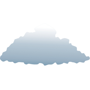
Low clouds: Stratocumulus 1
Illustration of stratocumulus clouds, belonging to a class characterized by large dark, rounded masses, usually in groups, lines, or waves. Weak convective currents create shallow cloud layers because of drier, stable air above preventing continued vertical development. Vast areas of subtropical and polar oceans are covered with massive sheets of stratocumuli
Low clouds: Stratocumulus 1

Low clouds: Stratus 1
Illustration of stratus clouds, meaning layer or blanket in Latin. Characterized by horizontal layering with a uniform base. Flat, featureless clouds of low altitude varying in color from dark gray to nearly white obscuring the disk of the sun. Essentially above-ground fog formed either through the lifting of morning fog or when cold air moves at low altitudes over a region
Low clouds: Stratus 1

Middle clouds: Altocumulus 1
Illustration of a cloud belonging to a class characterized by globular masses or rolls in layers or patches. Alto, "high", cumulus, "heaped". Usually white or gray, and often occurs in sheets or patches with wavy, rounded masses or rolls. Often are seen preceding a cold front, and their presence on a warm, humid, summer morning frequently signals the development of thunderstorms later in the day
Middle clouds: Altocumulus 1

Middle clouds: Altostratus 1
Illustration of an altostratus cloud; also referred to as "billow clouds," "windrow clouds," or "wave clouds," variations of the undulatus can be elements that have merged or single elements that have stretched through the sky
Middle clouds: Altostratus 1
. Nimbo is from the Latin word")
Middle clouds: Nimbostratus 1
Illustration of a nimbostratus cloud, a rain cloud characterized by a formless layer that is almost uniformly dark gray, of medium altitude, usually developing above 6500 ft (2000 m). Nimbo is from the Latin word "nimbus" meaning rain. They may block a great amount of sunlight as a result of their characteristic dense structure
Middle clouds: Nimbostratus 1


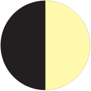
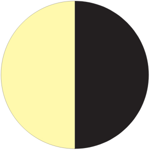
Moon: first quarter
Illustration of the moon undergoing phases; first quarter is heading towards a full moon
Moon: first quarter


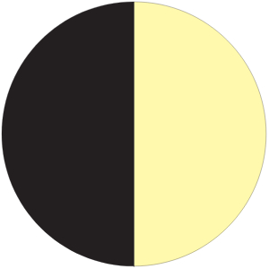
Moon: last quarter
Illustration of the moon undergoing phases: last quarter is heading towards a new moon
Moon: last quarter
 portion of the Moon faces almost directly toward Earth, so that the Moon is not visible to the naked eye")
Moon: new
Illustration of the moon undergoing phases: new moon. The Moon, in its monthly orbital motion around Earth, lies between Earth and the Sun, and is therefore in conjunction with the Sun as seen from Earth. At this time, the dark (unilluminated) portion of the Moon faces almost directly toward Earth, so that the Moon is not visible to the naked eye
Moon: new
 crescent (name of shape), heading towards a new moon")
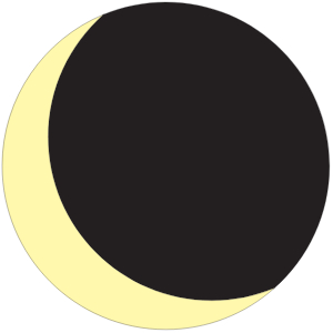
Moon: waning crescent
Illustration of the moon undergoing phases; waning (decreasing in size) crescent (name of shape), heading towards a new moon
Moon: waning crescent
 gibbous (name of shape), heading towards a new moon")
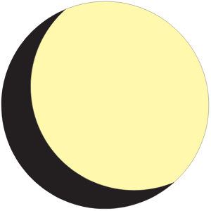
Moon: waning gibbous
Illustration of the moon undergoing phases; waning (decreasing in size) gibbous (name of shape), heading towards a new moon
Moon: waning gibbous
 crescent (shape), heading towards a full moon")
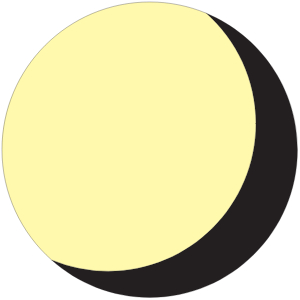
Moon: waxing crescent
Illustration of the moon undergoing phases; waxing (increasing) crescent (shape), heading towards a full moon
Moon: waxing crescent
 gibbous (name of shape), heading towards a full moon")
Moon: waxing gibbous
Illustration of the moon undergoing phases; waxing (increasing in size) gibbous (name of shape), heading towards a full moon
Moon: waxing gibbous

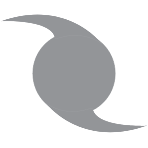
Weather: cyclone (S Hemisphere)
Illustration of a hurricane, or tropical cyclone: a storm system characterized by a low pressure center and numerous thunderstorms that produce strong winds and flooding rain. Depending on its location and strength, a tropical cyclone is referred to by names such as hurricane, typhoon, tropical storm, cyclonic storm, tropical depression, and simply cyclone. Has counterclockwise rotation in the Northern Hemisphere and clockwise rotation in the Southern Hemisphere due to the Coriolis Effect
Weather: cyclone (S Hemisphere)

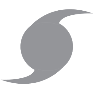
Weather: hurricane (N Hemisphere)
Illustration of a hurricane, or tropical cyclone: a storm system characterized by a low pressure center and numerous thunderstorms that produce strong winds and flooding rain. Depending on its location and strength, a tropical cyclone is referred to by names such as hurricane, typhoon, tropical storm, cyclonic storm, tropical depression, and simply cyclone. Has counterclockwise rotation in the Northern Hemisphere and clockwise rotation in the Southern Hemisphere due to the Coriolis Effect
Weather: hurricane (N Hemisphere)


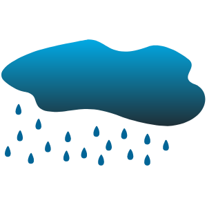
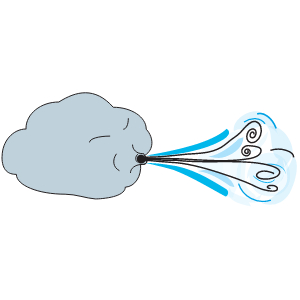
Weather: sheeting rain

")
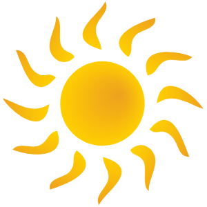
Weather: solar radiation
Illustration of the sun, symbolizing solar radiation (energy from the sun)
Weather: solar radiation

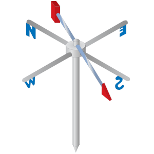
Weather vane
Illustration of weather vane
Weather vane


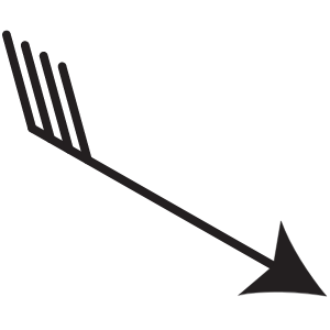
. The term can also apply to the resultant wind vector which is sometimes drawn as an arrow with length proportional to wind speed")
Weather: wind vector
Illustration of a wind vector, the two- or three-dimensional vector describing the instantaneous wind magnitude and direction at a point (often using Cartesian coordinates; i.e. X and Y wind vectors). The term can also apply to the resultant wind vector which is sometimes drawn as an arrow with length proportional to wind speed