Ecosystem


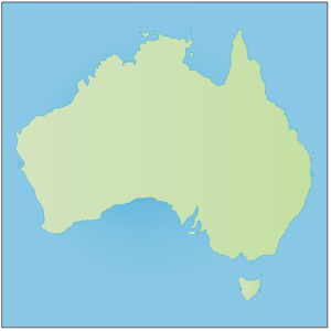
Australia QLD: Bramble Bay

Australia QLD: Deception Bay

Australia QLD: Eastern Moreton Bay

Australia QLD: Gold Coast
Illustration of Gold Coast in Queensland, Australia
Australia QLD: Gold Coast

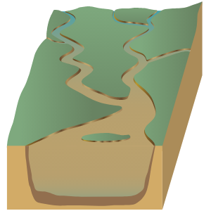
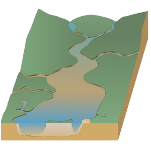
Australia QLD: Lockyer Creek
Illustration of ecosystem base with Lockyer Creek in Queensland, Australia
Australia QLD: Lockyer Creek

Australia QLD: Logan River

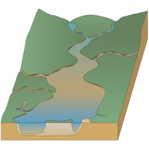
Australia QLD: Maroochy River
Illustration of ecosystem base with Maroochy River in Queensland, Australia
Australia QLD: Maroochy River

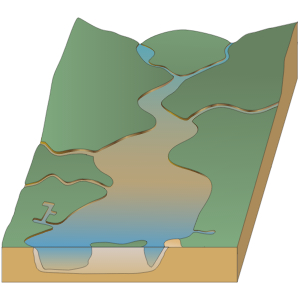
Australia QLD: Mid Brisbane River
Illustration of ecosystem base with Mid Brisbane River in Queensland, Australia
Australia QLD: Mid Brisbane River

Australia QLD: Mooloolah River

Australia QLD: Noosa River

Australia QLD: North Pine Dam

Australia QLD: Pumicestone Passage

Australia QLD: Somerset Dam
Illustration of ecosystem base with Somerset Dam in Queensland, Australia
Australia QLD: Somerset Dam

Australia QLD: Southern Moreton Bay Islands
Illustration of ecosystem base with Southern Moreton Bay Islands in Queensland, Australia
Australia QLD: Southern Moreton Bay Islands

Australia QLD: Stanley River

Australia QLD: Upper Brisbane River

Australia QLD: Waterloo Bay

Australia QLD: Wivenhoe Dam


Civil Engineering: Cross vane weir

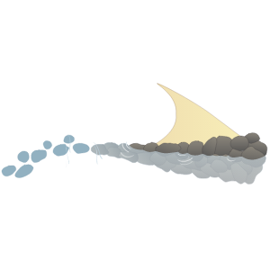
Civil Engineering: Flow deflector (J-hook Vane)
Illustration of a flow deflector, or J-hook Vane, used to dissipate stream energy and reduce bank erosion
Civil Engineering: Flow deflector (J-hook Vane)

Coast to coast USA 2D
A 2D cross-section of US topography, from the Pacific Ocean to the Atlantic Ocean
Coast to coast USA 2D

Coastline 2D: catchment, river, nearshore and offshore reefs
Illustration of two-dimensional coastline base of gradient from catchment to river to nearshore and offshore reefs
Coastline 2D: catchment, river, nearshore and offshore reefs

Coastline 2D: clastic and carbonate sediment
Illustration of two-dimensional coastline base with clastic and carbonate sediments
Coastline 2D: clastic and carbonate sediment

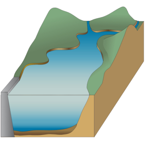
Coastline 2D: closed estuary and nearshore reefs
Illustration of 2-dimensional coastline base of a closed estuary with nearshore reefs
Coastline 2D: closed estuary and nearshore reefs

Coastline 2D: coastal floodplain
Illustration of a coastal floodplain
Coastline 2D: coastal floodplain

Coastline 2D: dunes to open ocean
Illustration of coastline base from dunes to open ocean
Coastline 2D: dunes to open ocean

Coastline 2D: estuary to deep reef
Illustration of coastline base gradient from deep reef to shallow reef, exposed sand, protected sand, and estuary
Coastline 2D: estuary to deep reef

Coastline 2D: gradual 5 degree slope

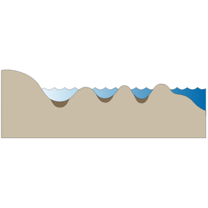
Coastline 2D: intertidal zone

Coastline 2D: open estuary and nearshore reef
Illustration of coastline base with open estuary and nearshore reef
Coastline 2D: open estuary and nearshore reef

Coastline 2D: receding shoreline

Coastline 2D: sand dune system
Illustration of coastline base with sand dune system gradient from sea level to berm, frontal dune, and inner barrier system
Coastline 2D: sand dune system

Coastline 2D: sand dune system with lagoon
Illustration of coastline base with sand dune gradient from sea level to berm, frontal dune, outer barrier system, lagoon, and inner barrier system
Coastline 2D: sand dune system with lagoon

Coastline 2D: sea ice shelf

Coastline 2D: sea level rise

Coastline 2D: sheltered vs. exposed with calcareous sediments
Illustration of sheltered vs. exposed coastline base with calcareous sediments